

Image credit: Eliza Tasbihi at Flickr
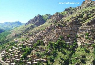
Tucked away in the northwest corner of Iran is the quaint and mysterious thirteenth century village of Kandovan. Located in Iran’s East Azerbaijan Province, Kandovan is 60 km south of the provincial capital Tabriz in Osku county. The 60 km drive to Kandovan south from Tabriz passes through Khosrowshahr and ascends the slopes of the hills at the base of Kuh-e (Mount) Sahand through the Osku Chai valley. Chai or Chay is a Turkic word for river.
The village of Kandovan is also part of the Lake Urmia region (also spelt Urmiyeh or Urmiya), the region where the predecessors of the Persians and the Medes first entered recorded history in a 844 BCE Assyrian inscription, and the region that is central to the start of the second phase of Zoroastrian history.
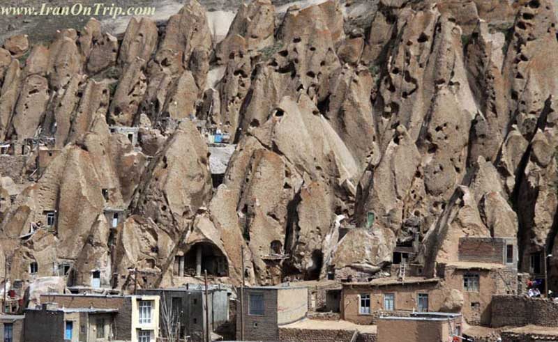
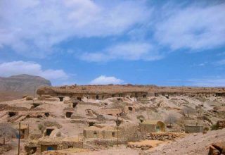
What makes Kandovan village so unique is that many of its homes have been made in caves located in cone-shaped, naturally formed compressed volcanic ash formations that make the landscape look like a gigantic termite colony. This method of dwelling makes the residents modern-age cave dwellers or troglodytes. (Troglodyte means cave dweller: somebody living in a cave, especially somebody who belonged to a prehistoric cave-dwelling community. Troglodyte also means somebody living in seclusion.)
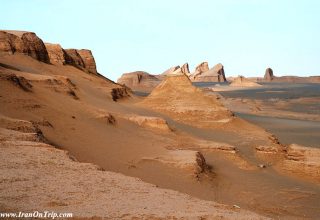
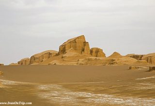
It is our understanding that the unusual cone formations were formed from volcanic ash and debris spewed during an eruption of Mount Sahand being hardened and shaped by the elements over thousands of years. The formation of volcanic ash cones is local to Kandovan. Elsewhere, the ash blanketed the land. The existence of a high volume of ash and pumice far from Sahand’s crater indicates that Mount Sahand erupted with a gigantic explosion in the distant past. Sahand’s rock is about a million years old and the last eruption of Mount Sahand is thought to have occurred within the Holocene epoch, that is within the last 11,000 years. Today, Mount Sahand is an dormant volcano consisting of a crater lake encircled by twelve peaks, the tallest of which rises to a height of 3707 m. or 12,162 feet.

Natural Beauty in the Sahand Region
While Mount Sahand itself is somewhat stark, the surrounding country abounds in a natural beauty that is today but a shadow of a legendary past. Some believe that legendary past beauty is preserved in the biblical story of the Garden of Eden. Ancient Persian gardens, also called baghs, where renowned for their spectacular beauty. Their name pairidaeza became the English word paradise. The baghs were a paradise on earth.
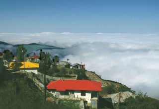
Nature’s gifts in Kandovan extend to the healing properties of its natural spring water. In particular, the waters have traditionally been used to help dissolve kidney and bladder stones. Some of the area’s wild plants as also reputed to have healing and vitality-giving properties. The combination of Kandovan’s unique natural landscape, beauty, and the manner in which its inhabitants have adapted to the environment, has made Kandovan a popular destination for visitors. About 300,000 people visit the village each year (the resident population is only 670) and a cave hotel with ten rooms (see photographs at the bottom of this page) was opened in 2007 to accommodate visitors who wish to stay over a night or more. Before the opening of the hotel, visitors to Kandovan were obliged to make a day trip from Tabriz 60 km to the north. It is only a matter of time before the local population begins to rely on tourism as a major source of income, thereby supplanting their traditional pastoral and agricultural way of life.

Use of Caves as Human Dwellings
As we have noted previously, in the area of Kandovan, Sahand’s volcanic ash and debris was compressed and shaped by natural forces into cone-shaped pillars containing pockets that became caves. The hardened material of the pillars is strong enough to function as walls and floors of a house while permitting a further shaping of the caves. The material is also an efficient insulator and the troglodyte’s homes have the reputation of being very energy efficient, remaining cool in summer and warm in winter. The cave homes require minimal supplemental heat during the long cold season, making for comfortable year round habitation.
Most of the cave houses are two to four storeys in height. In a typical four storey house, the ground or first floor is used as an animal shelter, the next two floors are used as living areas, and the top floor is used for storage. There are reports of tunnels connecting towers owned by a person or family.

Meaning of Kandovan
The houses are known as karan in the local dialect. One interpretation has the word Kandovan being a plural form of kando, a bee’s hive. Another interpretation says that Kandovan means Land of Unknown Carvers. The use of ‘van’ to indicate the plural is found in the Avesta: cf. ashavan. Nowadays, residents speak a Turkic dialect but have traditional Iranian family names, names such as Kayani. The mountains and rivers in the region have both Persian and Turkic – and perhaps even Assyrian – names.

Kandovan’s Age
The present residents say that their village is around 700 years old, and was formed by people fleeing from an advancing Mongol army and who used the caves as a refugee and a place of hiding. Even after the Mongol occupation of the country came to an end, many of the refugees decided to continue living in the caves and gradually expanded their cave homes to form permanent multi-storey houses. Another legend states that eight hundred years ago a body of soldiers hid in the caves during a military campaign.
However, there are indications that the present cave dwellers are successors of earlier 1600-3000 years ago cave dwellers which would have made them contemporaneous to the first known presence of Zoroastrians in the region.
References:


